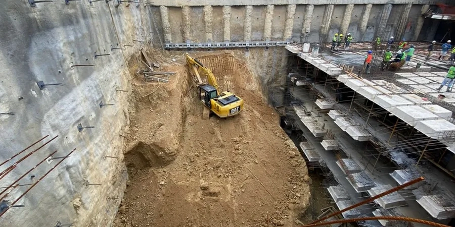
A deep excavation in Downtown Brampton, where dense Halton Till overlies fractured shale, demands a fundamentally different shoring strategy than a cut in the sandier soils near Heart Lake. The contrast across the city is stark — what works on a tight infill site on Main Street often fails to account for the groundwater perched within the sandy interbeds common in the eastern suburbs. Our geotechnical team has spent years correlating borehole data across Brampton, mapping how the Oak Ridges Moraine deposits transition into the glaciolacustrine clays that challenge even the most experienced excavation contractors. When you are going down three or four levels for an underground parking structure, understanding the in-situ stress history and the potential for base heave is not optional. We integrate the CPT test data with laboratory triaxial results to calibrate numerical models that predict wall deflections before the first bucket of soil is removed, giving contractors and structural engineers a reliable baseline for the temporary works design.
Accurate prediction of wall deflection in Brampton’s stiff clays depends on capturing the true undrained shear strength profile — generic correlations miss the post-peak softening behavior.
Local considerations
The freeze-thaw cycles that characterize Brampton’s winter months introduce a risk profile that southern Ontario engineers know all too well. Saturated clay faces exposed during a multi-month excavation can degrade rapidly when temperatures oscillate around the freezing point, leading to localized sloughing that compromises the lagging and, in extreme cases, undermines the soldier pile embedment. Our designs account for this seasonal exposure by specifying protective membrane covers and accelerated shotcrete application from November through March. Beyond the climatic concerns, the proximity of many downtown excavations to century-old masonry structures requires that we limit angular distortion to less than 1/500 — a criterion that often governs the stiffness of the bracing system more than the internal structural capacity of the wall. We use the Clough and O’Rourke envelope charts, adapted for the stiffness of Brampton’s overconsolidated tills, to estimate settlement troughs and advise on the need for underpinning or compensation grouting adjacent to sensitive heritage buildings.
Applicable standards
NBCC 2020 (National Building Code of Canada, Division B, Part 4), CSA A23.3:19 (Design of Concrete Structures), CGS CFEM 4th Edition (Canadian Foundation Engineering Manual), ASTM D7181-20 (Consolidated Drained Triaxial Compression Test), MTO’s Manual on Temporary Works for Excavations
Common questions
What are the typical costs for a deep excavation design in Brampton?
How long does it take to complete the geotechnical design for a deep excavation?
A typical design schedule spans four to six weeks. The first two weeks focus on interpreting the geotechnical investigation data and developing the ground model. The subsequent weeks involve the staged numerical modeling, structural design of the shoring elements, and the preparation of the IFC drawing package, with an additional week reserved for peer review and revisions.
Which shoring system works best in Brampton’s Halton Till?
Soldier pile and lagging systems are very effective in the stiff Halton Till because the material can stand unsupported for short lifts between the piles, reducing the amount of exposed face. However, when groundwater is perched within sandy interbeds or when adjacent structures are within the zone of influence, a more rigid system like a secant pile wall provides better control of ground loss and settlement.
Do you handle the structural design of the bracing and walers?
Yes, our scope includes the full structural design of walers, struts, and corner braces in accordance with CSA S16 for steel and CSA A23.3 for concrete. We coordinate closely with the project structural engineer to ensure that the temporary bracing reactions are compatible with the permanent structure’s floor slabs and foundation elements.
What level of monitoring is required during the excavation?
We typically specify inclinometers installed behind the shoring wall at a spacing of no more than 20 meters, along with optical survey prisms on the wall face and on adjacent buildings. Piezometers are installed at multiple depths to track the performance of the dewatering system, with readings taken daily during active excavation and weekly during periods of inactivity.